
Geomatics & UAV
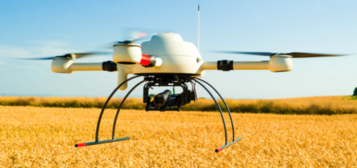
AWSE operates a microdrone UAV platform with LiDAR, GNSS + IMU direct georeferencing and 42/100 MP cameras — from mission planning to processing and visualisation.
Services delivered
- Corridor mapping for roads, transmission mains and pipelines
- Mining and quarry volume computation
- Construction progress monitoring
- Environmental change detection (time series)
- Forestry, contour mapping and earthworks
- Highway and railway alignment support
Indoor geomatics services for AWSE Engineering
With the fast-growing development of AWSE Engineering activities, it was appropriate to have indoor geomatics services. AWSE decided to acquire drones / UAV (Unmanned Aerial Vehicle) equipped with proficient tools for many geomatics applications.
Sensor payloads
The UAV carries a LiDAR (Light Detection And Ranging) sensor, a GNSS (Global Navigation Satellite System) receiver coupled with an IMU (Inertial Measurement Unit) for Direct Georeferencing (DG), and a high-resolution camera to capture the imagery required by the mission.
Direct Georeferencing (DG)
Direct Georeferencing is the ability to directly geolocate sensor data from the air to the ground with respect to a reference coordinate system. At its core, DG combines GNSS and inertial technology to produce a robust position and orientation solution — a true revolution for georeferencing LiDAR and for aerial photogrammetry in high-accuracy mapping.
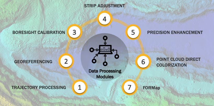
Data processing modules
A structured chain of processing modules turns raw sensor data into survey-grade deliverables — from trajectory to colorised point clouds and final maps.
LiDAR scan pattern
The scan pattern of the airborne LiDAR sensor produces a dense, homogeneous coverage of the ground — the geometric basis for high-accuracy point clouds and derived terrain models.

Sierra Leone references
Related references will be showcased as they are made public.