Back to expertise
Water Resources
AWSE brings together hydrology, hydrogeology and river engineering to secure water resources and reduce exposure to natural hazards.
Services delivered
- Hydrology, hydrogeology and hydro-meteorology
- Watershed and water-resources management
- Resource assessment for water supply and hydropower potential
- Natural hazards, river engineering, flood and sediment transport
- Hydrometry and above/below-water surveys
- Climate-change adaptation and mitigation studies
Watershed characterisation & flood risk mapping
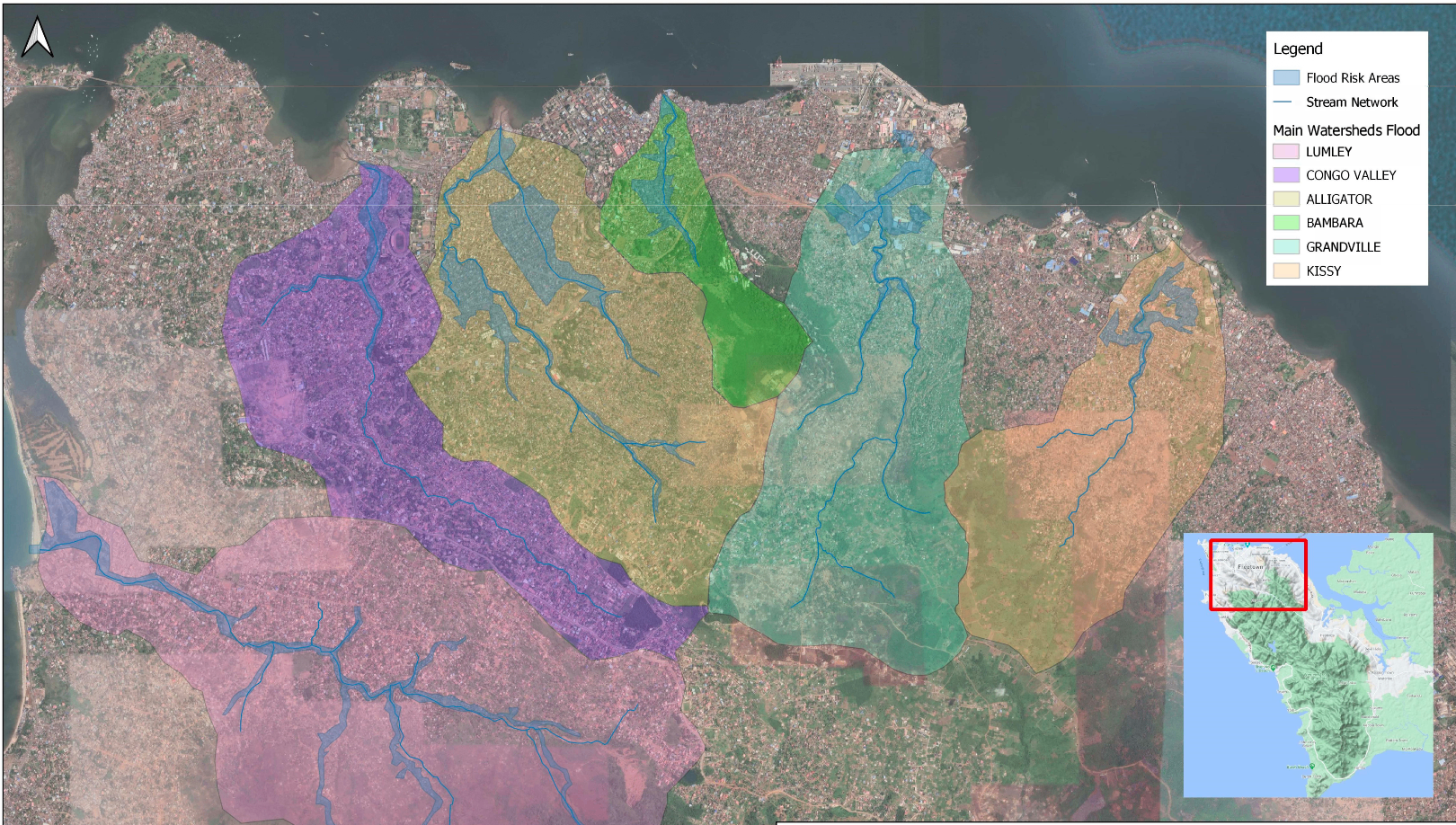
Water resources studies require a clear spatial reading of catchments and drainage. AWSE delineates urban watersheds, maps stream networks and flood risk areas across Freetown to inform stormwater design, land-use planning and safeguards.
Sierra Leone references
View referencesSierra Leone references
2020African Development Bank (AfDB)
Guma Valley — Freetown Water Supply & Sanitation Priority Investments (PIP)
Guma Valley Water Company
Water SupplyWater ResourcesHydrogeology & Drilling
View project2021African Development Bank (AfDB)
Guma Valley — Hydrogeological investigations, consolidated feasibility & IFC-standard ESIA
Guma Valley Water Company
Water SupplyWater ResourcesE&S Safeguards
View project