From resource assessment to detailed design and tender documents, AWSE delivers the full engineering value chain for drinking-water supply projects.
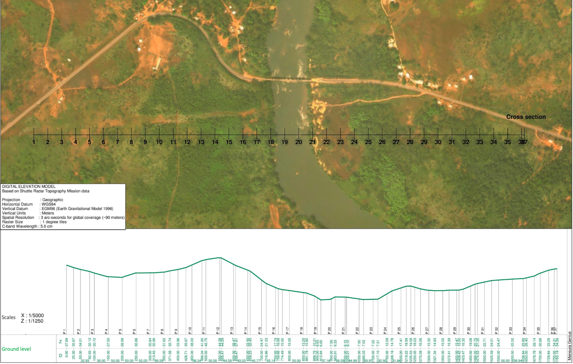
Digital Elevation Model (SRTM, WGS84 / EGM96) with river cross-section — resource and site assessment for a rural water supply scheme, Sierra Leone.
Services delivered
Feasibility studies and project management
Conceptual, preliminary and detailed design
Technical specifications and Bills of Quantities
International-standard tender documents
PPP structuring for the water sector
Hydraulic model development for supply networks
Resource assessment & hydraulic modelling
Water supply projects start with a rigorous reading of the terrain and of the water cycle. AWSE combines digital elevation modelling with hydraulic and flooding simulations to secure siting, sizing and safeguards decisions.
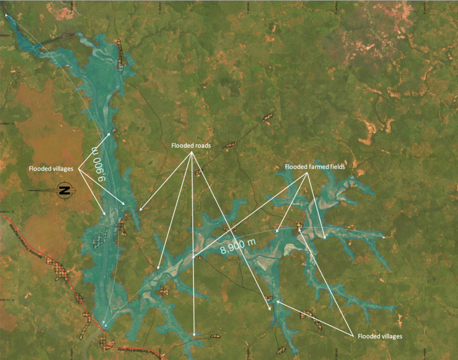
Digital Elevation Model (SRTM, WGS84 / EGM96) with river cross-section — resource and site assessment for a rural water supply scheme, Sierra Leone.Reservoir flooding model — extent over villages, roads and farmed fields used to inform siting, sizing and safeguards, Sierra Leone.